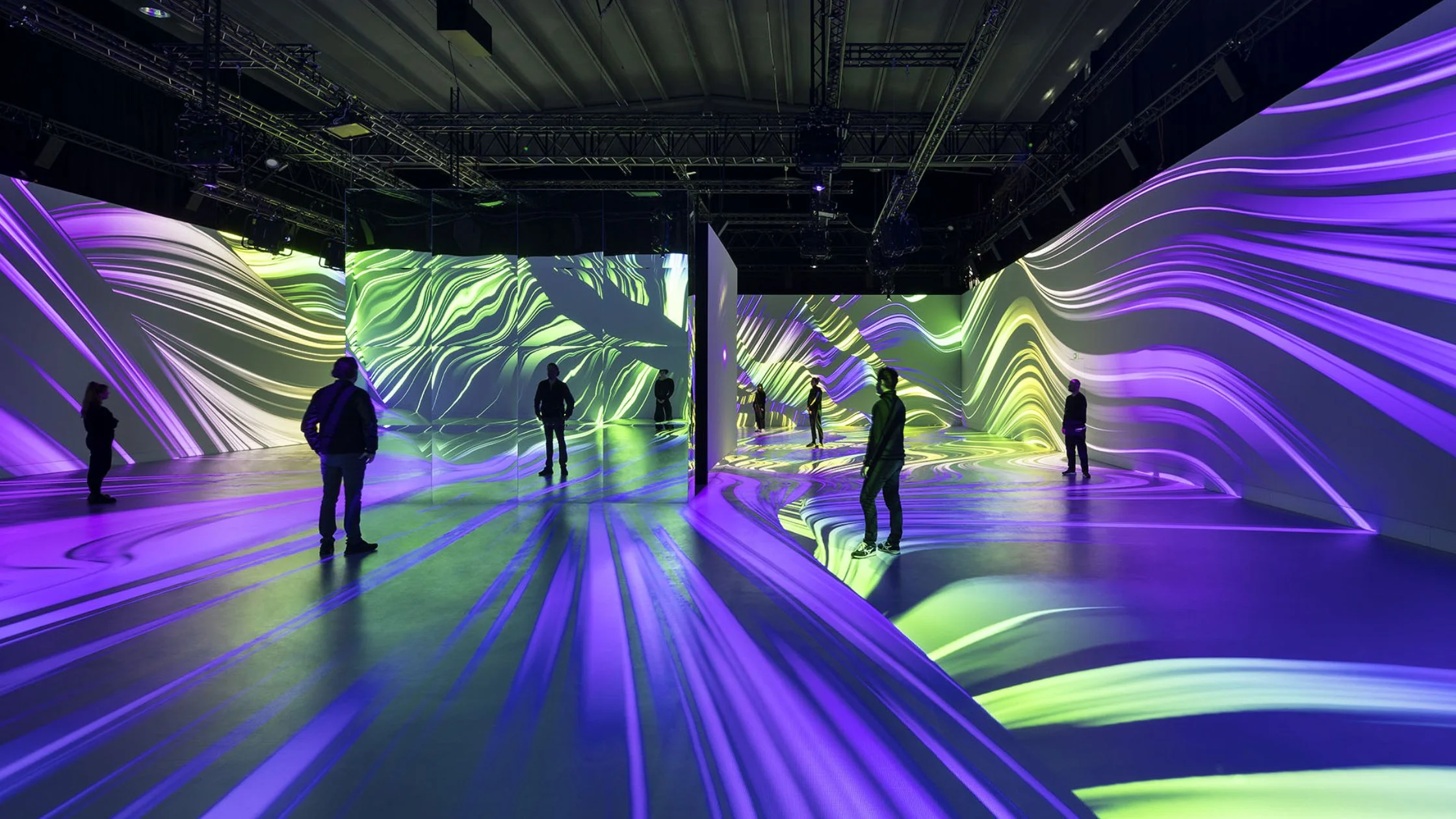
Projection mapping has transformed the way we interact with buildings, public spaces, and city landmarks. Gone are the days when architecture was admired solely in daylight or static illumination. Today, projection mapping allows artists, designers, and technologists to transform ordinary urban surfaces into extraordinary experiences — blending technology with creativity to turn rigid facades into dynamic canvases of light.
Architectural projection mapping is a subgenre of this powerful medium, using building projection mapping, façade mapping, and 3D architectural visuals to create immersive experiences that enthrall audiences worldwide. From cultural storytelling to brand activations, this artistic and technical phenomenon is shaping the next frontier in urban expression.
This blog will explore:
Techniques for mapping on buildings
Challenges in outdoor architectural projections
Examples from global light festivals
Best practices for structural mapping accuracy
Integration with city planning and public art
Let’s dive in.
Techniques for Mapping on Buildings
Mapping onto architecture involves more than simply pointing a projector at a wall. Due to the complex geometry of buildings, the process demands precise planning, advanced tools, and an artistic eye. Here are the major techniques used:
1. 3D Scanning and Modeling
One of the first steps in architectural projection mapping is creating a 3D model of the structure. Tools like LiDAR scanners, photogrammetry, or laser scanning help capture the minute architectural details — windows, columns, arches, ledges, and textures.
This digital model becomes the canvas on which the projection content is designed. With 3D modeling software like Blender, Cinema 4D, or Maya, artists can develop animations that conform perfectly to the structure's geometry.
2. Content Creation Using Mapping Software
Mapping software translates digital visuals into real-world coordinates. Popular tools include:
MadMapper
Resolume Arena
TouchDesigner
HeavyM
3. Warping and Edge Blending
Projection warping compensates for visual distortions caused by projecting on uneven surfaces. Edge blending ensures multiple projectors overlap seamlessly for a unified display, critical for covering large or multi-faceted buildings.
4. Motion Tracking and Real-Time Interactivity
Cutting-edge projects now integrate motion tracking, allowing visuals to respond to audience movement. Real-time engines like Unreal Engine and Notch allow for live-generated visuals, elevating the immersive experience of urban projection art.
Challenges in Outdoor Architectural Projections
Despite its wow factor, architectural projection mapping comes with real-world hurdles that artists and technicians must navigate.
1. Environmental Interference
Unlike indoor projection mapping, outdoor environments are unpredictable. Weather conditions like rain, fog, wind, and temperature can impact projection clarity or equipment function. Additionally, ambient light from streetlamps or nearby buildings can dilute brightness and color contrast.
2. Structural Complexity
Older buildings with historical facades often feature intricate surfaces — arches, cornices, and sculptures — that complicate the mapping process. Not all surfaces are flat or perpendicular, requiring customized content for each zone of the building.
3. Permitting and Legal Constraints
Public building projections usually require permits from city councils or heritage authorities. Content also needs to comply with cultural sensitivities, noise ordinances, and nighttime usage regulations.
4. Equipment Logistics and Power Requirements
High-powered projectors (often 20,000 lumens or more) are needed for large-scale projections. These devices are bulky, generate heat, and require stable mounting platforms and power sources. Planning for rigging, cabling, and setup times can be logistically intense.
Examples from Global Light Festivals
Light festivals around the world showcase the pinnacle of building projection mapping. These events blend culture, innovation, and storytelling to mesmerize millions of viewers annually.
1. Vivid Sydney – Australia
Held annually since 2009, Vivid Sydney is a globally renowned light and art festival. Its centerpiece? The Sydney Opera House becomes a living canvas through projection mapping that celebrates Indigenous culture, marine life, and local art.
Technique Highlight: Artists use ultra-wide projectors and custom-mapped content to match the Opera House’s unique shell-like forms.
Impact: Over 2 million visitors attend, boosting the economy and global visibility for artists and technologists.
2. Festival of Lights – Berlin
This German event transforms historical landmarks like the Berlin Cathedral and Brandenburg Gate into immersive storytelling stages. Through façade mapping, artists reinterpret history, freedom, and social change using brilliant colors and motion.
Technique Highlight: Highly detailed 3D models of neo-classical architecture enable synchronized light and audio shows.
Impact: The event emphasizes urban projection art as a form of cultural expression and tourism magnet.
3. Fête des Lumières – Lyon, France
Rooted in tradition, Lyon’s light festival has evolved into a modern spectacle of architectural visuals. Artists from around the globe transform churches, bridges, and theaters into interactive pieces of art.
Notable Projects: Projection on the Basilica of Fourvière used real-time animation to simulate flying creatures circling the structure.
Cultural Importance: Encourages civic pride while allowing emerging digital artists a stage to shine.
These festivals prove that projection mapping is not just tech — it’s cultural innovation in action.
Best Practices for Structural Mapping Accuracy
To ensure projection mapping on buildings looks seamless, a meticulous workflow must be followed. Here are the best practices for ensuring precision and visual harmony:
1. Pre-Production Site Surveys
Conduct a thorough site inspection to measure distances, identify projector placement, and assess lighting conditions. Use tools like total stations or laser rangefinders for accurate measurements.
2. Create a High-Fidelity 3D Model
Using software such as SketchUp, Rhino, or AutoCAD, develop a detailed digital model. Ensure dimensions are accurate to within a few centimeters, especially if working on historical or ornate facades.
3. Test Small Segments First
Before rendering the full animation, test short video loops on the surface. This “test and refine” approach helps avoid costly rendering errors and reveals how the building’s texture interacts with light.
4. Use Masking and Layering
Create masks in your content that correspond to the building's architectural features. Layer your animations to add depth, motion, and visual rhythm that aligns with the structure’s natural lines.
5. Align Audio with Visual Triggers
For shows with sound design, align visual transitions with audio beats or narrative cues. Syncing these elements enhances the emotional impact and creates a multisensory experience.
6. Calibrate Projectors Precisely
Use grid overlays and mapping tools to calibrate projector alignment. Adjust keystone settings and lens shifts to remove distortion, and lock down the physical position of the projector securely.
Integration with City Planning and Public Art
Beyond the wow factor, architectural projection mapping is becoming an important element in urban design and public engagement.
1. Urban Regeneration and Storytelling
Cities are using projection mapping to reintroduce forgotten or underused buildings to the public. By layering storytelling over dormant spaces, local governments can spark interest in urban regeneration projects.
Example: A derelict factory in Detroit was mapped with a time-lapse history of the city’s auto industry, inspiring community dialogue and development funding.
2. Enhancing Public Art Initiatives
City planners now integrate projection mapping into public art master plans. Temporary installations allow for seasonal, cultural, or political themes without permanent physical changes to public space.
3. Educational and Civic Messaging
Projection mapping is also used for educational campaigns — from climate change awareness to public health information. The dynamic visuals increase attention retention, particularly in younger audiences.
Example: In Tokyo, a city-funded project projected real-time air quality data on high-rise buildings, making pollution data visible and actionable.
4. Building Community Through Interactivity
Interactive mapping projects — where citizens can submit artwork or influence live visuals via mobile apps — foster a sense of community ownership and artistic engagement.
Conclusion: The Future of Projection Mapping in Urban Spaces
Architectural projection mapping is more than a fleeting spectacle — it is a powerful storytelling and design tool that merges art, data, and infrastructure. From overcoming technical challenges to aligning with city development goals, the success of any mapping project lies in deep collaboration between artists, engineers, and municipal stakeholders.
As cities seek new ways to connect with their citizens, building projection mapping and façade mapping are becoming essential components of urban design. By animating spaces with 3D architectural visuals and promoting dialogue through urban projection art, projection mapping redefines how we view, use, and relate to our built environment.
At Scale Up Spaces, we believe in the power of visual innovation. Our mission is to empower creators, cities, and organizations to elevate their spaces through cutting-edge projection mapping solutions. Whether you're illuminating a landmark or revitalizing a city square, we're here to help you turn vision into reality — and buildings into breathtaking works of art.